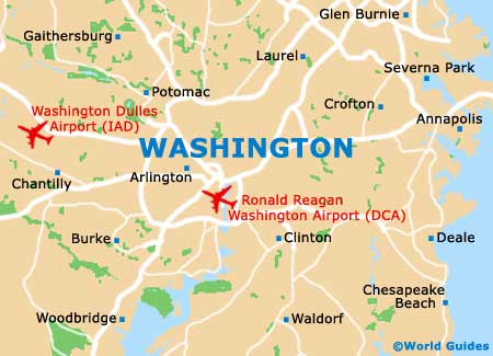
Ronald Reagan Washington National Airport (DCA)
Orientation and Maps
(Washington, District of Columbia (DC), USA)
Without doubt one of America most famous cities, Washington DC is the country's political hub, being home to the president, the White House, the Supreme Court, the Library of Congress and the Federal Bureau of Investigation (FBI). Washington also contains more than its fair share of topnotch tourist attractions and becomes particularly busy each year during Independence Day, when huge parades and concerts take place.
The city of Washington is served by three main airports, of which the Ronald Reagan Airport (DCA) is the closest to the city center. The airport is located directly south and along the eastern banks of the Potomac River, next to the George Washington Memorial Parkway. Close to Baltimore, Richmond and Alexandria, the city is well connected to all of these cities and more by Amtrak trains and Greyhound buses.
Ronald Reagan Washington Airport (DCA) Maps: Important City Districts
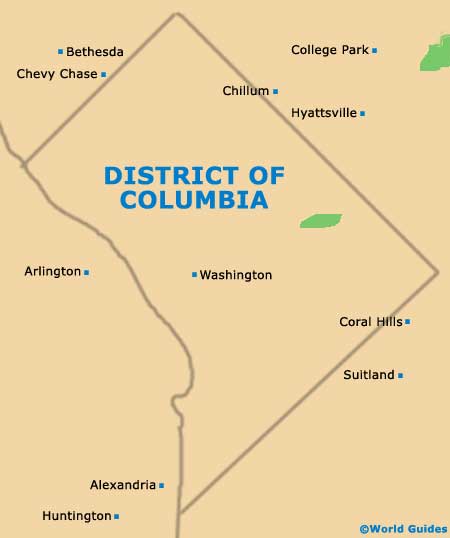
Washington is a vast and sprawling city that is composed of numerous important districts. Amongst the most important, Capitol Hill has much to offer, including food markets, superb restaurants and much more besides. Foggy Bottom is also a popular place to visit and is sandwiched between 17th Street and Rock Creek Park, being home to the George Washington University.
On the northern side of the world-famous White House estate, Dupont Circle is a fashionable and attractive part of the city and features many elegant neighborhoods and opportunities for fine dining. The Georgetown district is an especially historic part of Washington and contains the campus of Georgetown University, which dates back to the end of the 18th century.
USA Map

District of Columbia Map
Washington Map